The Great Miami River, Stillwater River and Mad River, along with Twin Creek, Greenville Creek and Buck Creek, make up one of only 35 national water trail systems (designated by the U.S. Department of the Interior) and the only one in Ohio. The three rivers are state-designated water trails, too. And the Stillwater River and Greenville Creek are state-designated Scenic Rivers.
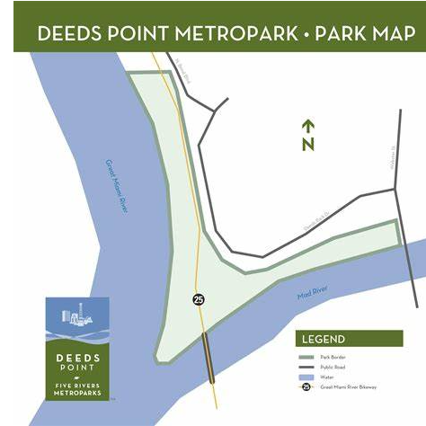
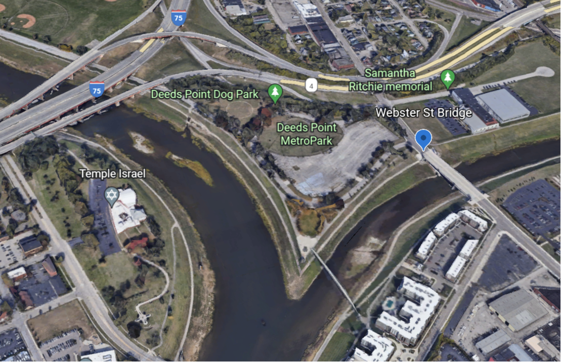
Switch to Map ViewAmenities Drinking water Recreation Trail Access On street parking About This small MetroPark provides an unobstructed and picturesque view of the downtown Dayton skyline, embraced by the beauty of nature.
Amenities Recreation Trail Access Deeds Point This small MetroPark provides an unobstructed and picturesque view of the downtown Dayton skyline, embraced by the beauty of nature.
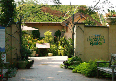
Amenities Parking Lot Picnic Area Recreation Trail Access About DeWeese Park Area has many things to offer. Take a day to stroll through formal gardens and the delightful Children’s Discovery Garden. Every season has something special to offer. The Children’s Discovery Garden is a child-friendly place to experience our worl ...
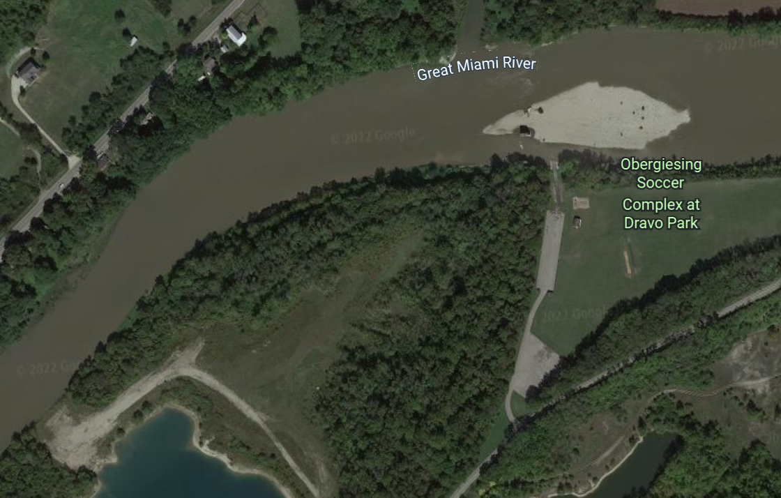
Amenities Parking lot Restrooms Picnic area Boat Ramp About Our communities had so much in common, including a deep love for soccer, the Board of Trustees decided to honor this long-standing friendship by renaming Dravo Park the Obergiesing Soccer Complex at Dravo Park. In this same spirit of making connections across cultures ...
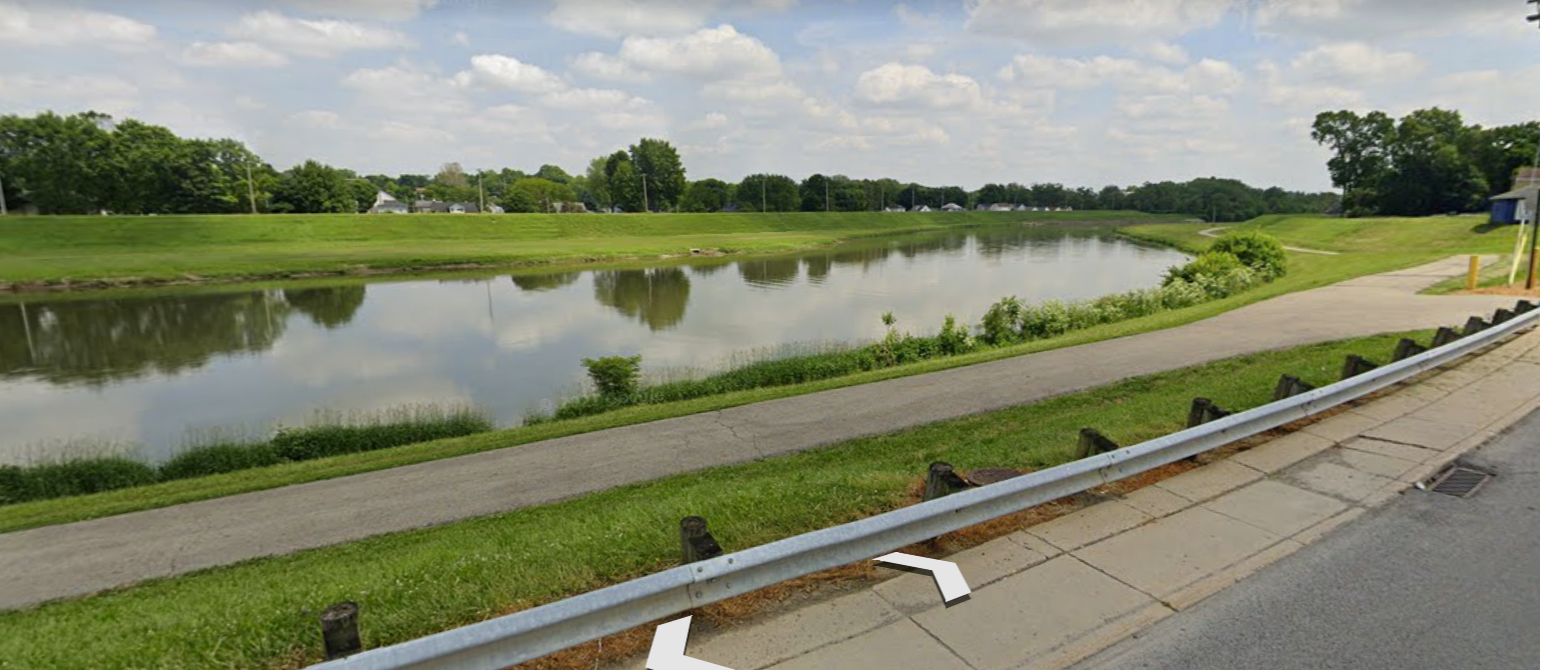
Amenities: Roadside Parking Recreational Trail Access
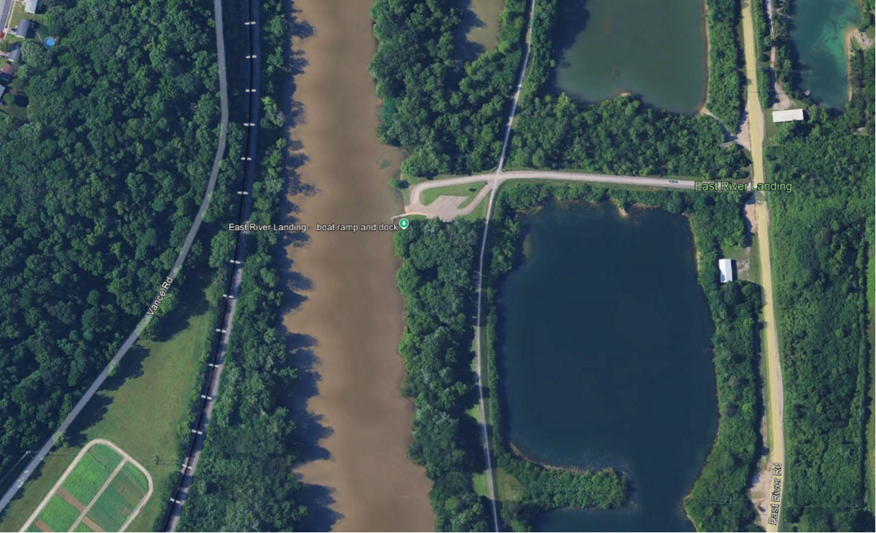
Amenities Parking Lot Boat Ramp Recreation Access About Parking, informational kiosks and Accessible boat dock
Off of Harshman Road small rapid Amenities Parking Lot Recreational Trail Access Picnic Area Restrooms Whitewater Feature Drinking water About Eastwood MetroPark is a hub of outdoor recreation. With a variety of water-based recreational activities as well as land-based recreational and leisurely activities, the park offers ...
Amenities Parking lot Boat Ramp The Great Miami Boat launch is located in Dayton, Ohio. Kayakers can launch from under the Riverside Bridge along the Great Miami Recreational Trail, and the cost to participate is $15 per person per hour. The location is in the City of Riverside.
Amenities Parking Lot Boat Ramp Picnic Area Drinking Water Restrooms EV Charger The Stillwater River, lakes, woods and wetlands serve as focal points of this 1,900-acre MetroPark. They provide the setting for fishing, birdwatching and picnicking. Discover the beauty of woodlands, meadows and three waterfalls.