The Great Miami River, Stillwater River and Mad River, along with Twin Creek, Greenville Creek and Buck Creek, make up one of only 35 national water trail systems (designated by the U.S. Department of the Interior) and the only one in Ohio. The three rivers are state-designated water trails, too. And the Stillwater River and Greenville Creek are state-designated Scenic Rivers.
Switch to Map ViewLarge pipe across river (portage right or left with caution)
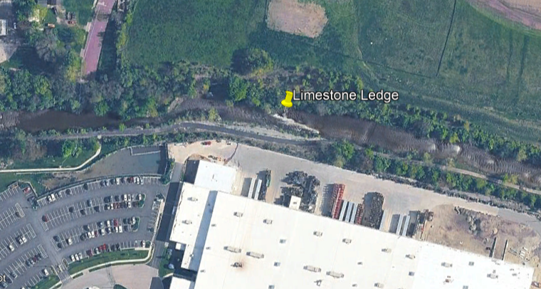
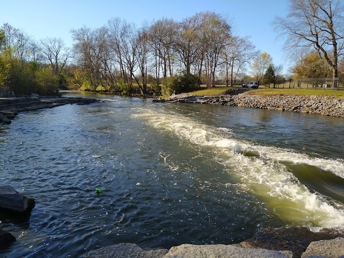
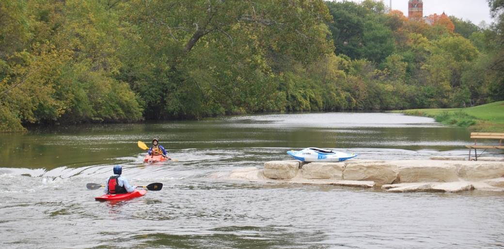
(Chute left - Class II+) Portage right Boaters can paddle nine whitewater features as they pass beneath the new Springfield Regional Medical Center. In addition, the natural limestone shelf-rapids further upstream complete a 6 mile run from Buck Creek State Park, through downtown, to the confluence of the Mad River. An added bonus - ...
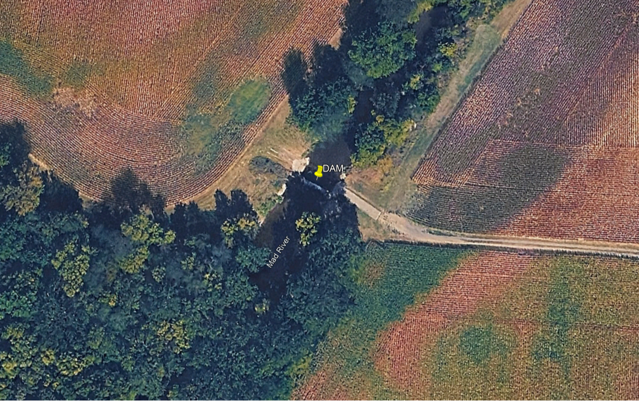
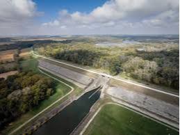
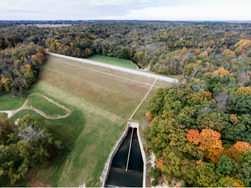
Portage right Amenities Parking Lot Whitewater feature Recreation Trail Access US Army Corps of Engineers started the Buck Creek flood control project in 1966. In 1974, the Clarence J. Brown, Sr. Dam and Reservoir were dedicated and an agreement gave the Ohio Department of Natural Resources the operation of much of the area. ...
Whitewater Feature Drop 1 (Class I), Drop 2 (Class II), Drop 3 (Class II+), Drop 4 (Class II)
Amenities Parking Restrooms Drinking Water Picnic Area
Smith Park is a 96 acre park featuring playground equipment, picnic tables and shelters, grills, baseball diamonds, soccer fields, football fields, a skatepark, splash pad, trails, a seven acre fishing pond, and a floating dock. This location is frequently used for some of the city's larger events, such as Light Up Middletown holiday lig ...
Discover one of our community’s largest parks! Snyder Park connects your family to 226 acres of nature and recreation right in your community. Iconic landmarks like Old Stone Bridge, placid lagoons and the boathouse line main roadways. Immerse yourself in the best free fun Clark County has to offer! Connect with nature by embarking on ...
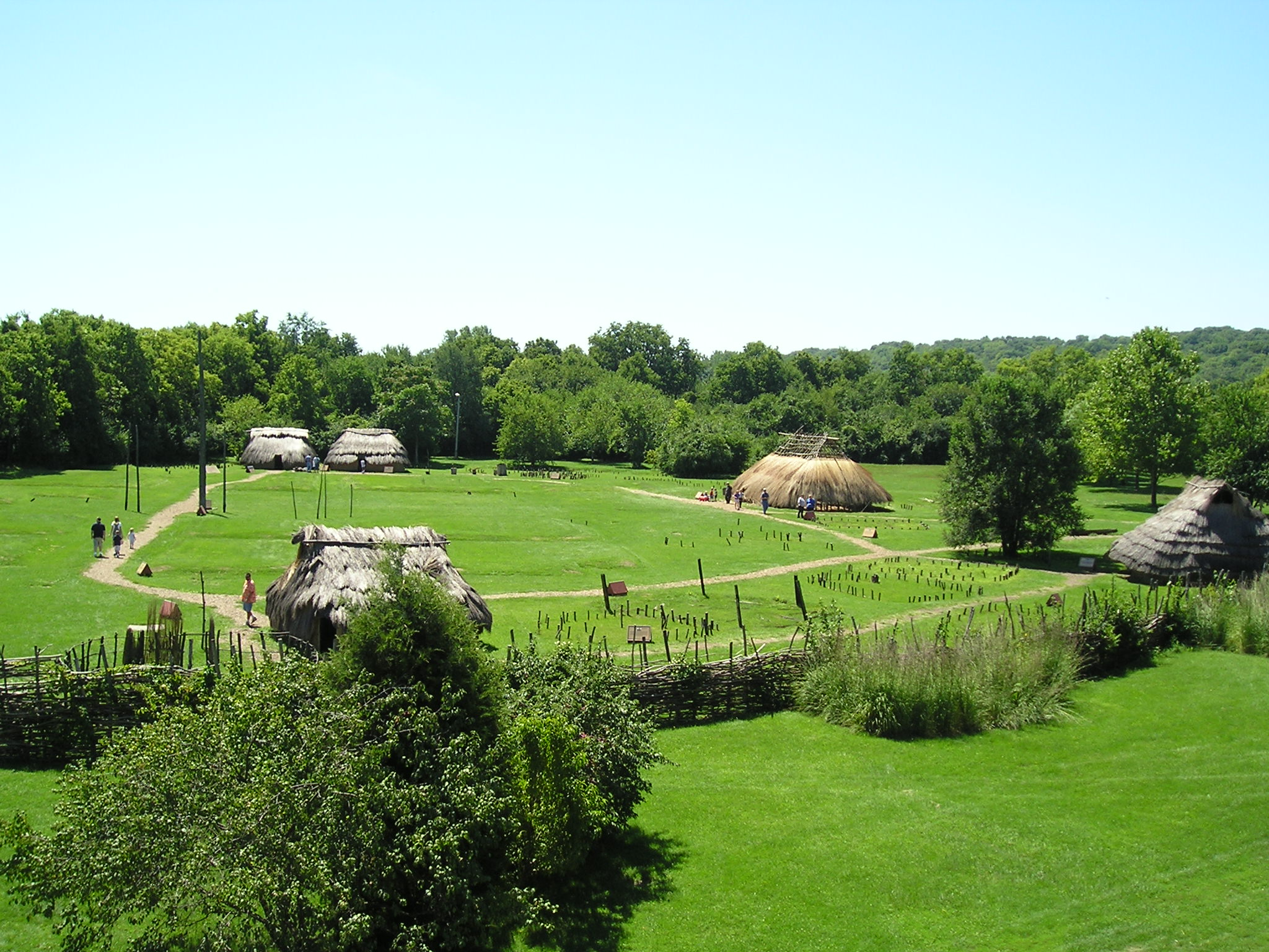
SunWatch, originally named the Incinerator Site, was first excavated and reported on in the 1960s by amateur archaeologists John Allman and Charles Smith. When news came in the early 1970s that the City of Dayton planned to expand a nearby sewage treatment plant onto the property and impact the site, Allman and Smith contacted James Heilm ...
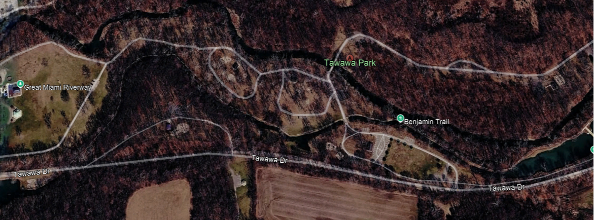
About The City of Sidney took over operation of this facility in 1955. It was formerly under the guidance of the Tawawa Civic Park Trustees that was incorporated in May of 1948. The original members listed in 1948 were: Wayne Bertsch Murray A. Ferguson William Milligan WE. Whipp, J. Oliver Amos Cecil Watkins Jerome Wagner The Park consis ...
The area that is now Taylorsville MetroPark was once one of the busiest crossroads in the country, the meeting place of major transportation arteries — the Old National Road, Great Miami River, the Miami-Erie Canal and railroads. Today, the area serves as the crossroads of bike trails, hiking trails and river recreation. Some hig ...